 The City of Baguio is a 1st class highly urbanized city in northern Luzon in the Philippines. Baguio City was established by Americans in 1900 at the site of an Ibaloi village known as Kafagway. Baguio City was designated by the Philippine Commission as the Summer Capital of the Philippines on June 1, 1903 and incorporated as a city by the Philippine Assembly on September 1, 1909. The name of the city is derived from the word bagiw in Ibaloi, the indigenous language of the Benguet Region, meaning 'moss'.
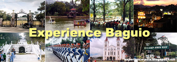
Baguio Tourist Spots
Baguio City is home to many tourist spots and is a weekend getaway of those living in Metro Manila.
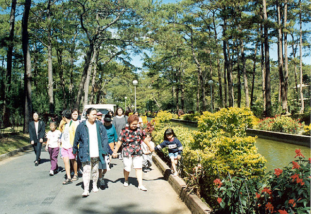
Burnham Park
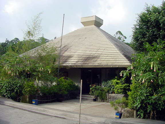
Located at the center of the city, it is named after the city's planner, Daniel Burnham. The park features a promenade and a man-made lagoon where bancas (rowboats) are available for hire. At the center of the lake is a seldom used "dancing fountain" that sprays water to a height of 50 feet. The park has cycling areas, a children's park, and a covered skating rink. At the northeast portion is a soccer field, with Melvin Jones Grandstand at one end where concerts are performed. Local plant varieties and flowers are sold at the City Orchidarium on the eastern side of the park. The southern area of the park is occupied by the Athletic Bowl, once the best track and field oval in Southeast Asia, and the new Olympic Swimming Center.
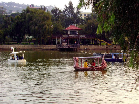 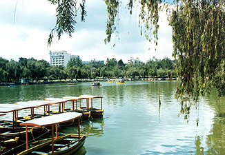
The park is a favorite place of local residents and visitors alike. There are different facilities for recreation and relaxation that are available in the park. You can row a boat, have a picnic, attend an outdoor concert, watch a football game, go biking, or just take a leisurely stroll around the park.
At the southern end of the park is a circular skating rink where skates can be rented. There are also tennis and basketball courts, a few restaurants, outdoor kiosks, a children's playground, and an orchidarium where various kinds of plants, trees and flowers are sold. Chairs and benches are distributed around the park for those who just want to sit down and relax.
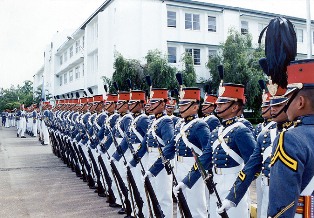
The football field at the eastern side of the park is sometimes used for parades, carnivals, concerts, political rallys, and for display booths during special events and activities. On certain Sundays and some special occasions, cadets of the Philippine Military Academy perform a parade and review or a silent drill exhibition at the field.
Burnham Park is an ideal place for taking photographs and a visitor should bring along a camera when going to the park. If in case you forget to bring a camera during your visit, there are commercial photographers in the park who can take your pictures. Pictures are usually delivered to you within just a few hours. It is best to determine and agree on the fee for the services of the photographer and the cost of the photographs before committing yourself to one.
Baguio Cathedral
A majestic church built on top a hill is visible from much of the city. The rose-colored Baguio Catholic Cathedral, on a hill in the heart of the city, a familiar Baguio landmark. This beautiful structure has twin spires and is one of the most photographed buildings in the city. From Session Road it is accessible via a long stairway. Visitors avoiding the climb drive up an access road.
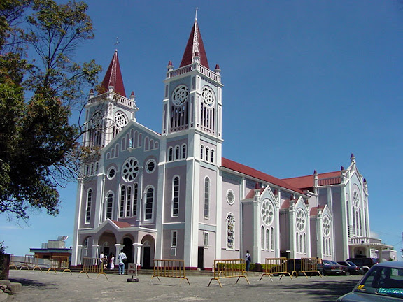 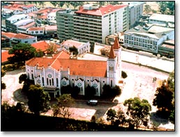
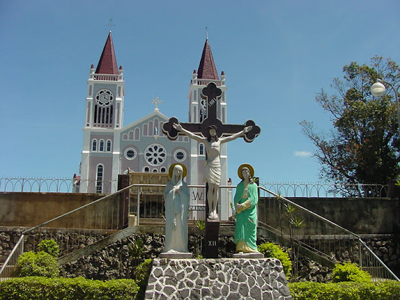 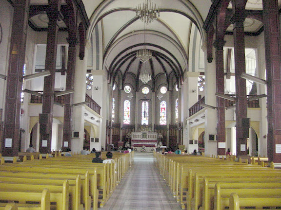
Construction of the cathedral was begun on a hill which was referred to as "Kampo" by the native Ibalois. It was later called Mount Mary by a Belgian Catholic Mission headed by Fr. Lorimund Carlu, CICM, the parish priest. The cathedral was consecrated in 1936 and dedicated to Our Lady of Atonement. During World War II it became an evacuation center and withstood Japanese carpet bombing in 1945, saving thousands of lives.
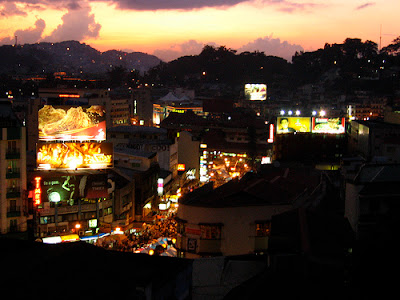
Session Road
The main avenue of the city and is its commercial center. Along the main street and sidestreets are numerous shops, restaurants, billiard halls, and duckpin bowling alleys. Located at the city center, it is actually divided into two parts:
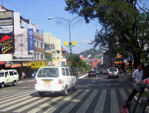 
Lower Session Road - extending eastward from Magsaysay Avenue (opposite the Plaza or Kilometer 0 and Malcolm Square) running through the BCBD until the intersections of Father Carlu Street (towards the Baguio Cathedral and Upper Bonifacio Street) and Governor Pack Road. This is the area where businesses are located, among others banks, shops, restaurants, bakeries, hotels, newsstands, boutiques, and studios.\
Upper Session Road - extending from Post Office Loop, Leonard Wood Road, and the foot of Luneta Hill (where SM City Baguio is located) to the rotunda cutting toward South Drive (towards Baguio Country Club), Loakan Road (towards Camp John Hay, Loakan Airport, Philippine Military Academy, the former Baguio Export Processing Zone, and the mine areas of Itogon, Benguet), and Military Cut-Off (towards Kennon Road)
Baguio Grand Mosque
There are several mosques and prayer rooms in the city, the largest being Baguio Grand Mosque at Campo Filipino. It caters to several thousand Muslim families from Mindanao as well as Cordillerans. The Mosque also houses an Islamic Madrasah.
Camp John Hay
Camp John Hay used was the rest and recreational facility for employees of the military and Department of Defense of the United States. This 690-hectare property was turned over to the Philippine government in July 1, 1991 and was initially administered by the Philippine Tourism Authority, then turned over to the Bases Conversion Development Authority.
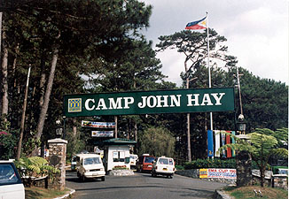 
The facility, named for U.S. President Theodore Roosevelt's secretary of war, was used by the Japanese as a concentration camp for American and British soldiers during the war. Its name was changed to Club John Hay after it was turned over to the Philippine government. It is now called Camp John Hay once again. The facility was opened to the public for the first time in 1991 and converted into a recreational complex. It had been off-limits to Filipinos, except for the privileged few who could get entry passes from its former American administrators. During the 1956-1958 period, however, and possibly later, admission to pedestrians as distinct from motor vehicle traffic had been relative free and required no particular invitation. One simply followed the sidewalk that led onto the base. It passed well to one side of the guard house where incoming motor vehicles were checked. Of course, once on the property admission to certain facilities, like the PX or the Officers Club (but not the Nineteenth Hole Restaurant), was restricted. There was also another limiting factor, an economic one. Payment for most services at John Hay Air Base was in US Military Payment Certificates (Script), not in Philippine Pesos.
Prior to its turnover to the Philippine government, there were 290 fully-furnished rooms in the cottages, duplexes, apartments, and lodges around the complex. It even had a "Honeymoon Cottage" for newlyweds. Each unit has a fireplace for warmth during December, January and February when Baguio is cold.
Mines View Park
Located at the extreme northeast of the city, it has a spectacular view of Benguet's gold and copper mines.
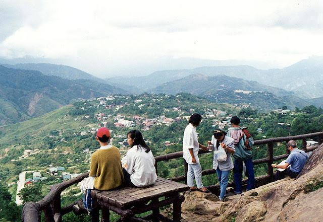 
Mines View Park is one of the most popular and most visited park in the city. From the observation deck of the park a breathtaking panoramic view of Benguet's gold and copper mines and the surrounding mountains unfolds before you. It is a spectacular sight to behold and should not be missed when visiting Baguio.
The park is usually the next stop taken by most visitors after seeing the Mansion or Wright Park. To reach the observation deck, you need to go down a winding stone-covered stairway which is just close to the parking area. One should be careful when ascending or descending the stairway just after a rain as the steps can be very slippery. There are a few benches at the promontory where you can sit down to rest and enjoy the view. For a few pesos you can rent a binocular and there are also some commercial photographers around just in case you want to have your picture taken. A visit to the park should also be planned earlier during the day as the view may not be visible when the fog starts to move in during the afternoon. However, this occurs only on certain months of the year.
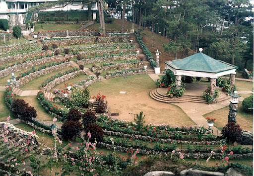
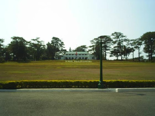
The Mansion
The official summer residence of the President of the Philippines. The Mansion is located on the eastern part of the city along Leonard Wood Road and across from Wright Park. Built in 1908 for U.S. governors-general, it was destroyed in 1945 during the battle for the liberation of the Philippines.
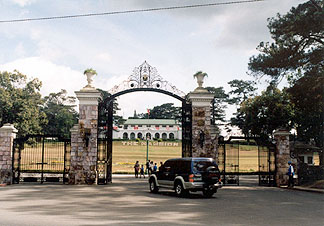 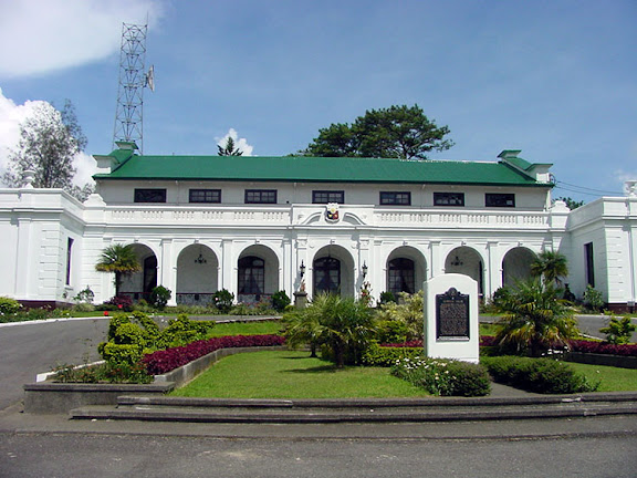
The Philippine government rebuilt and improved the structure in 1947. Since then it has been used by Philippine presidents during their official visits. The Mansion served as the seat of the Second Session of Economic Commission of Asia and the Far East in 1947. It has also been the site of first meeting of the South East Asia Union, popularly known as the Baguio Conference of 1950, conceived and convened by President Elpidio Quirino.
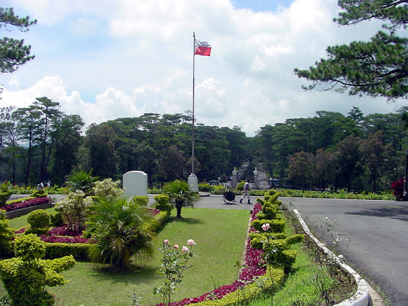 
The elaborate main gate of the Mansion is said to be a replica of the one at Buckingham Palace in London. Vehicles entering the compound pass through a great circular driveway, usually open only when the Mansion is used for official functions. With its beautiful gardens, it is a favorite site for sightseeing and photography.
Baguio Botanical Garden
Also known as the Igorot Village, it contains many Igorot houses amidst flora and fauna that grow in the cool climate of the city. Tourists often take pictures with Igorot tribesmen in traditional costume. It is the home of the Baguio Arts Guild, where they hold art workshops and portrait sittings.
 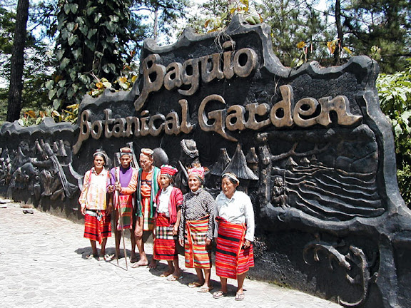
The Baguio Botanical Garden is located east of Baguio's downtown area. You will find it between Teacher's Camp and the Pacdal Circle. Its main entrance is along Leonard Wood Road and just across the street from Gilberto's Hotel and Baguio Vacation Hotel. It is quite a large park and about the same size as Burnham Park.
Originally the Botanical and Zoological Garden, it was home to the Baguio Zoo in the 1950's. The name changed to Imelda Park in the 1970s. Botanical Garden is tasked with growing pine seedlings and other flora and fauna for the constant "greening" of Baguio City.
The Orchidarium
A showcase for the flowers and plants grown around Baguio. Located on one side of Burnham Park, the Orchidarium has local plant varieties and flower species for sale.
Maryknoll Ecological Sanctuary
Provides ecotours of tropical flowers. To go to the sanctuary you can take the BGH-Campo Sioco bound jeepneys which are parked beside the Harrison Road overpass stairway, take a taxi, or drive your own vehicle. From the downtown area, proceed to the rotunda across the Baguio General Hospital then take the road to the right towards the direction of Marcos Highway. After passing Lina's Mart look out for the Amway and Agua Vida signages where you turn right and follow the road until you reach the Maryknoll gate.
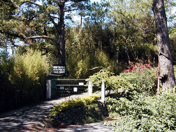  
The "Cosmic Journey" became the major undertaking within the Maryknoll Ecological Sanctuary. It is describe as "a nature walk of play and discovery into the earth's deep interconnectedness." A total of fourteen different stations were created to portray "the magnificence of the unfolding of the cosmos." The 1st station is about the coming into being of the Universe. The 5th and 8th stations portray the arrival of the mammals and the coming forth of the primates, respectively. The last two stations portray the Earth's religious tradition and a Bio-shelter.
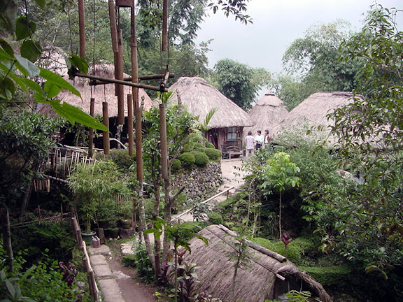
Tam-Awan Village
A picturesque artists' community with native huts with an art gallery, and coffee shop. It attracts many indigenous artists who hold exhibits and workshops there.
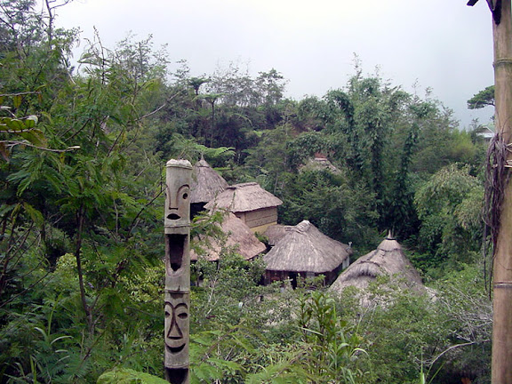 
There are a number of Igorot huts within the village which will allow you to see how the homes of the mountain people really look like. You do get a chance to climb up the wooden ladder and see what is inside each hut. This will give you a chance to feel what it is like to be living in one of these huts. Since these huts were set up on different locations on a hillside, visitors have to climb up the steep pathways to go from one hut to another. For a lowlander who is not accustomed to Baguio's high elevation, it does get to be quite an exhilarating experience to visit the Tam-Awan village. One will surely find a need to rest at each hut just to catch a breathe before climbing further up.
The village has a main hut which serves as a store and an information office for visitors. There are a few native handicraft items that are sold aside from some books and publications about the Igorot people, their culture and traditions. You can also order a hot cup of native coffee which gets to be a welcome treat after completing a tour of the entire village, especially on a cold and rainy day.
Asin Hot Springs
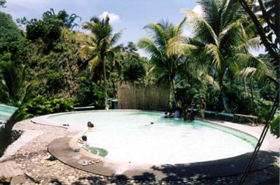
Located in Benguet but considered a city resource, it has a natural hotspring, where the city and private concerns have built swimming pools. The area is under-developed but is a place that tourists should consider visiting.
Wright Park
Named after Governor-Governor Luke E. Wright (who ordered architect Daniel Burnham to build Baguio as a recreational facility for American soldiers and civilians).
Wright Park, which is located at the eastern part of the city and fronting the main gate of the Mansion, is one of the many scenic parks in Baguio City. Its main features are a shallow elongated rectangular body of water known as the "Pool of Pines" and the park circle which is on one end of the park. Postcard-type photographs are usually taken at both ends of Wright Park and when going there it is best to bring along a camera.
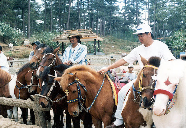 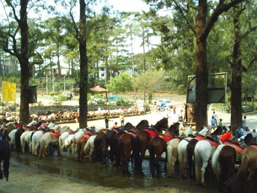
Tall pine trees and decorative street lights line both sides of the access road beside the pool. There are times that you will find at the park some Igorots dressed in their native attire and regalia who are willing to pose for a photograph ... of course, for a fee. Native handicrafts are also sold at the Mansion end of the park by a few Igorot peddlers. From the park circle is a walkway which leads to a wide stairway made of stones that descend to an area where ponies are rented out.
Philippine Military Academy
In 1950 the Academy moved from its former site at Teacher's Camp to a 373 hectare compound in Loakan, ten kilometers south of downtown Baguio. It is housed in a fort named after the hero of the battle of Tirad Pass, Gen. Gregorio Del Pilar.
The Academy site was developed into a military training institution with facilities for a growing military. Its unique 4-year curriculum has been designed to fit the needs of the Armed Forces of the Philippines. As in military academies in the US, female cadets have been enrolled by PMA since 1993.
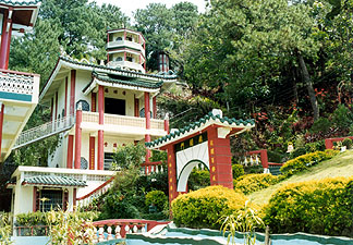
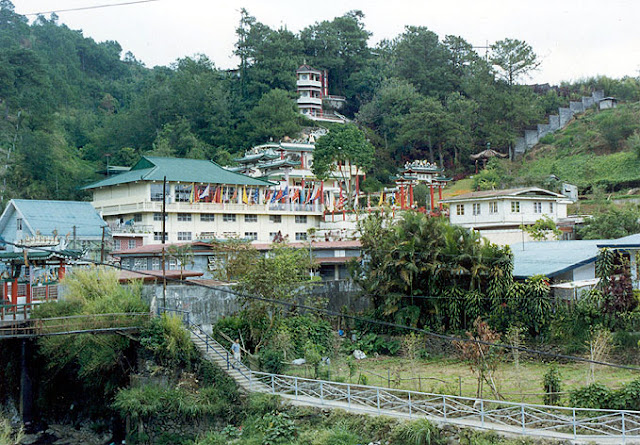
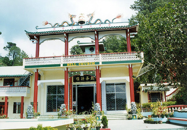
Bell Church
The Bell Church is located north of downtown Baguio along the road to La Trinidad, Benguet. In its compound are intricate arches and buildings adorned with flags, bells and dragons. It has a pagoda and beautiful gardens. There one can see Buddhist artifacts at Bell Church, as well as literature on Chinese history.
The Bell Church is located north of the downtown area of Baguio along the road leading to the town of La Trinidad, Benguet. Within its compound are intricately designed arches and buildings adorned with flags, bells and dragons.
It has a pagoda, and beautifully landscapped gardens. There are some artifacts about Buddhism that you will find at the Bell Church as well as some literature about the history of China.
It is during the Spring Festival or what is more commonly known in the West as the Chinese New Year that local and foreign Chinese tourists flock to the Bell Church. Like all Chinese festivals, the date of the new year is determined by the lunar/solar calendar rather than the Gregorian calendar. The observance of the holiday falls on a different date each year and it usually varies from late January to the middle of February. This Chinese public holiday is usually observed for 3 days although the festival traditionally starts with the new moon on the first day of the new year and ends on the full moon 15 days later. The 15th day of the new year is called the Lantern Festival which is celebrated at night with lantern displays and children carrying lanterns in a parade.
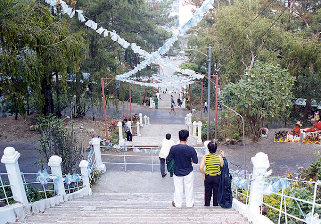
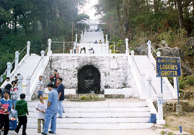
Lourdes Grotto
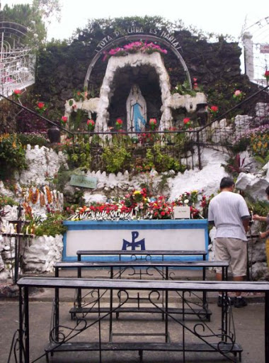 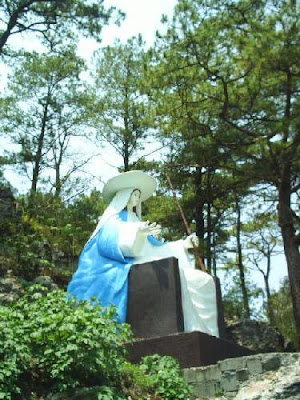
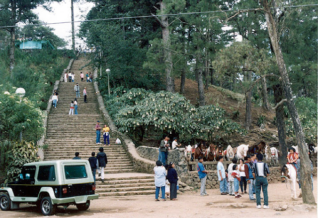
The Lourdes Grotto is a Catholic shrine in Baguio. It is located on a hill in the western part of the city, and houses an image of the Lady of Lourdes. It is a favorite pilgrimage site during Holy Week, especially during Holy Thursday and Good Friday. Access to the top of the grotto could be made by climbing the 252 steps or by driving a light vehicle through a winding, narrow and steep asphalt-paved road. Devotees who go up to the grotto to pray usually light up a candle at an altar below the image. There are also vendors at the shrine who are willing to light up a candle for you and say a prayer for whatever personal intentions you might have.
As it is in many other similar shrines, the grotto was constructed to commemorate the numerous visions of the Virgin Mary by a 14-year old French girl named Bernadette Soubirous. This happened in 1858 from February 11 to July 16 in the town of Lourdes which is in southwestern France. The visions were declared authentic by the Pope in 1862 and this also led to the authorization of the cult of Our Lady of Lourdes.
Rizal Park
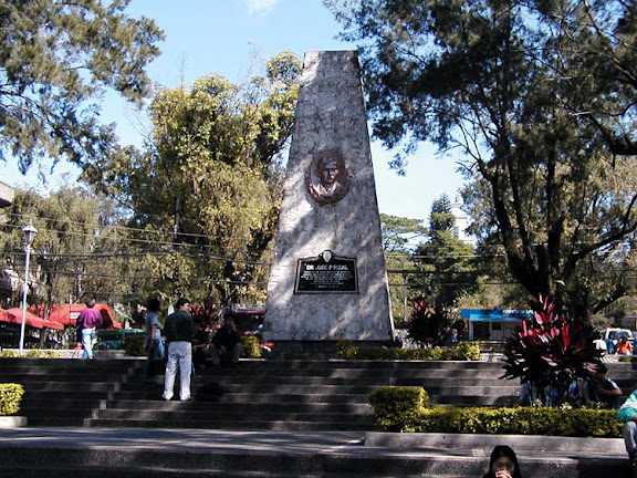 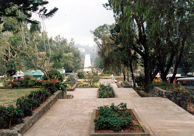
The park was erected in honor of Dr. Jose P. Rizal, the national hero of the Philippines and is similar to numerous other parks that are found in towns and cities all over the Philippines which are also named in his honor. It is on this site that the annual celebration honoring Rizal every 30th of December is held.
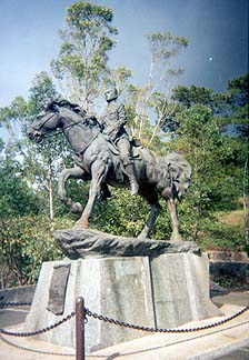
Aguinaldo Museum
The larger-than-life size statue of Gen. Emilio Aguinaldo and the museum beside it is an interesting Baguio landmark which could be found at the upper end of Gen. Luna Road in a vicinity referred to by local residents as Jungletown. It is just across the street from the Bonuan Restaurant and has a small park around the statue which is a favorite playground for young children who live nearby.
 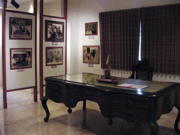 
The museum was erected to house personal memorabilia of Gen. Emilio Aguinaldo which include the different uniforms and barong tagalogs he once wore, his photographs and those of his family, a work desk, and the wheelchair which he used when he was confined at the Veterans Memorial Hospital. Also on display is a three-dimensional miniature scene depicting his inauguration as president and a replica of the Philippine flag which was originally designed by the general with revolutionary words embroidered on it.
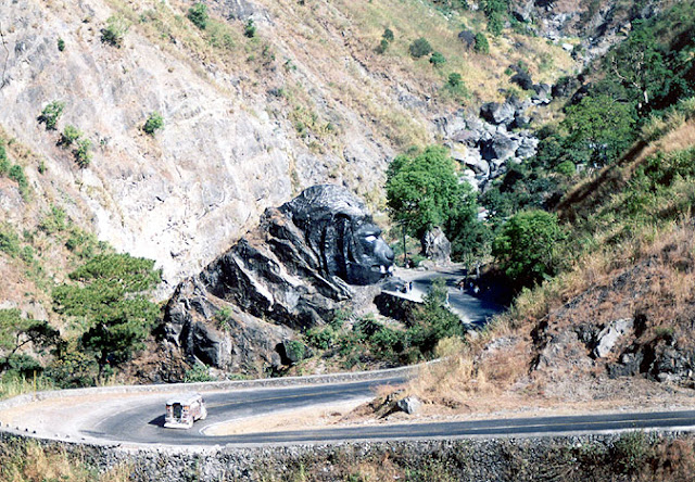
Lions Head
The lion's head along Kennon Road is the undisputed landmark that is synonymous to Baguio City. It is commonly said that a trip to Baguio City would not be complete without taking home a souvenir photograph with the famous lion head which serves as the backdrop on Kennon Road.
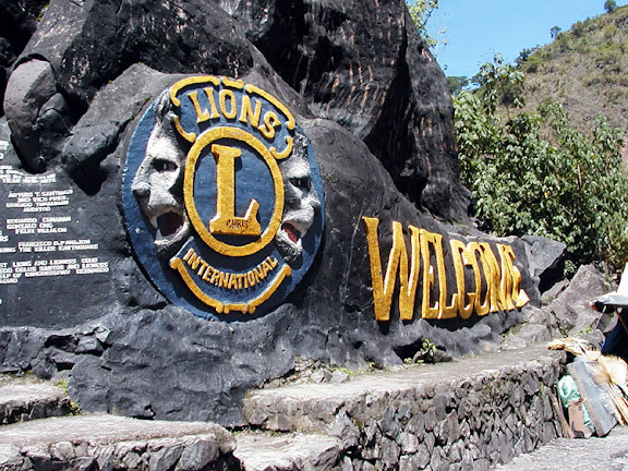 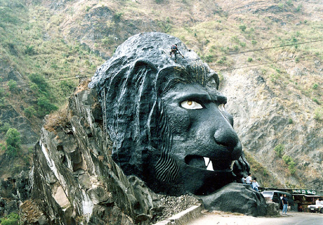
Local and foreign tourists make it a point to stop in Camp 6 and have their photographs taken at the base of the lion head. The 40-foot high lion head, located a few kilometers from the Kennon Road view deck, was carved by a Cordillera artist from a limestone boulder. Lions Club members of Baguio City thought of creating a symbol that would proclaim the presence of the group in this mountain resort city.
Some other frequently visited locations in the city include the Teacher's Camp, and the public market, a favorite place for tourists seeking souvenirs.
Transportation
Air transport
Loakan Airport in Baguio is about 20 minutes by car south of the city. Because of the length of the runway, commercial jet aircraft are not able to use the airport. The airport is only used by propeller-driven aircraft. Currently, Asian Spirit flies Sunday, Monday, Wednesday and Friday to and from Manila, a 50 minute flight. Flights to Baguio are scheduled only in the morning, as visibility approaches zero in afternoons when fog starts to form.
Land transport
It takes an average of six hours to travel the 250-km distance between Manila and Baguio by way of Kennon Road. It is about fifteen minutes longer through the Marcos Highway and could take three more hours when going through Naguilian Road. Kennon Road is occasionally blocked by landslides during the rainy season and the same problem occurs on the other two access roads. The route to Baguio through Kennon Road is as scenic as it is dangerous. There is another access to Baguio from Aritao in the province of Nueva Vizcaya but this is less traveled, the road is not well maintained, and public transportation through this route is not as regular. Another road, Halsema Road (also known as "Mountain Trail") leads north through the mountainous portion of the Cordillera Autonomous Region. It starts at the northern border of Baguio, in the Municipality of Trinidad (Trinidad Valley).
There are several bus lines linking Baguio with Manila and Central Luzon, and provinces such as Pangasinan, La Union, and those in the Ilocos region. Most transportation companies also offer express and air-conditioned buses at a much higher fare.
Bus services that ply Baguio include Philippine Rabbit, Dangwa Tranco, Dagupan Bus, Victory Liner, Partas, Genesis, Saulog Transit, and Greenland.
Labels: Baguio, Cities, Philippines |


